


.png)


Geography Image Gallery
by Media DeskPublished on: 3rd September 2020
Browse through selected images taken from Muslim Heritage articles related to Geography...

“Everywhere’s been where it is ever since it was first put there. It’s called geography.” ― Wyrd Sisters
…

- Google honors Al-Biruni’s Birthday with this Doodle
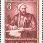
- USSR stamp, Abū Rayhān al-Bīrūnī, 6 copecks, 1973
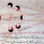
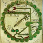
- An illustration from al-Biruni’s astronomical works, explains the different phases of the moon

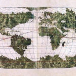
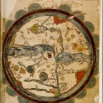
- The Tabula Rogeriana, by Al-Idrisi in 1154, is one of the most detailed maps of the ancient world. This map has been rotated to show its similarity with modern maps

- South Caucasus (Armenia)

- Matrakci’s Tebriz

- Granada/Spain and its surrounding areas

- Piri Reis’ depiction of the Mediteranean

- Al-Qazwini’s world map of the inhabited world, from cosmography

- World map from Mahmud el-Kashgari’s Diwan, 11th century

- Indian Ocean

- Sicily

- Mediterranean Sea

- Erzurumlu Ibrahim Hakki’s World Map in his Marifetname book

- Cyprus

- Piri Reis’s World map, 16th century
- Tarih-i Hind-i Garbi map, 16th Century
- Ali Macar’s world map

- City of Istanbul and Develi illumination from Matrakçi’s Beyân-i Menâzil-i Sefer-i ‘Irakeyn
- Czech National Library copy of al-Wardi’s map

- a copy of al-Wardi’s world map

- A copy of Ibn al-Wardi’s world map
- 16th century copy of Al-Qazwini’s world map from his “Marvels of Regions”

- Al-Idrisi’s 12th century world map

- World map from the Book of Curiosities manuscript held at the Bodley Library

- Persian Gulf’s coast

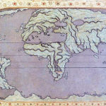
- A world map by Abu Ishaq Ibrahim ibn Muhammad al-Farisi al-Istakhri (934 CE) aka Estakhri. The map is oriented with South at the top, a common feature of maps at the time. Picture displayed on “Old Manuscripts and Maps from Khorasan”

- A map by Abu Zaid Ahmed ibn Sahl al-Balkhi (850-934), a Persian geographer who was a disciple of al-Kindi and also the founder of the “Balkhī school” of terrestrial mapping in Baghdad. Picture displayed on “Old Manuscripts and Maps from Khorasan”

- Turkish Stamp

- A portrait of Marco Polo wearing a Tatar outfit
- Mahmud of Kashgar’s map of world (Divânu Lügati’t-Türk, translated into Turkish by Rifat Bilge, Istanbul 1917, 3 vols

- Imaginary potrait of Mahmud of Kashgar/Mähmut Qäşqäri

- Introduction page from Divânu Lügati’t-Türk

- Coordinates of Piri Reis map

- Portrait of Pîrî Reis

- A Turkey Republic bank note contains Pîrî Reis’ map
Images are taken from the following articles:
When the World was Upside Down: Maps from Muslim Civilisation by Cem Nizamoglu, Khaleel Shaikh
The Oldest Map of Japan Drawn by Mahmud of Kashgar by Sevim Tekeli
Earliest maps of America by Sevim Tekeli
***
“Can you see the sunset real good on the West side? You can see it on the East side too.” ― The Outsiders
No hay comentarios:
Publicar un comentario